Winter solstice: The longest night of the year and the start of winter | Weather News

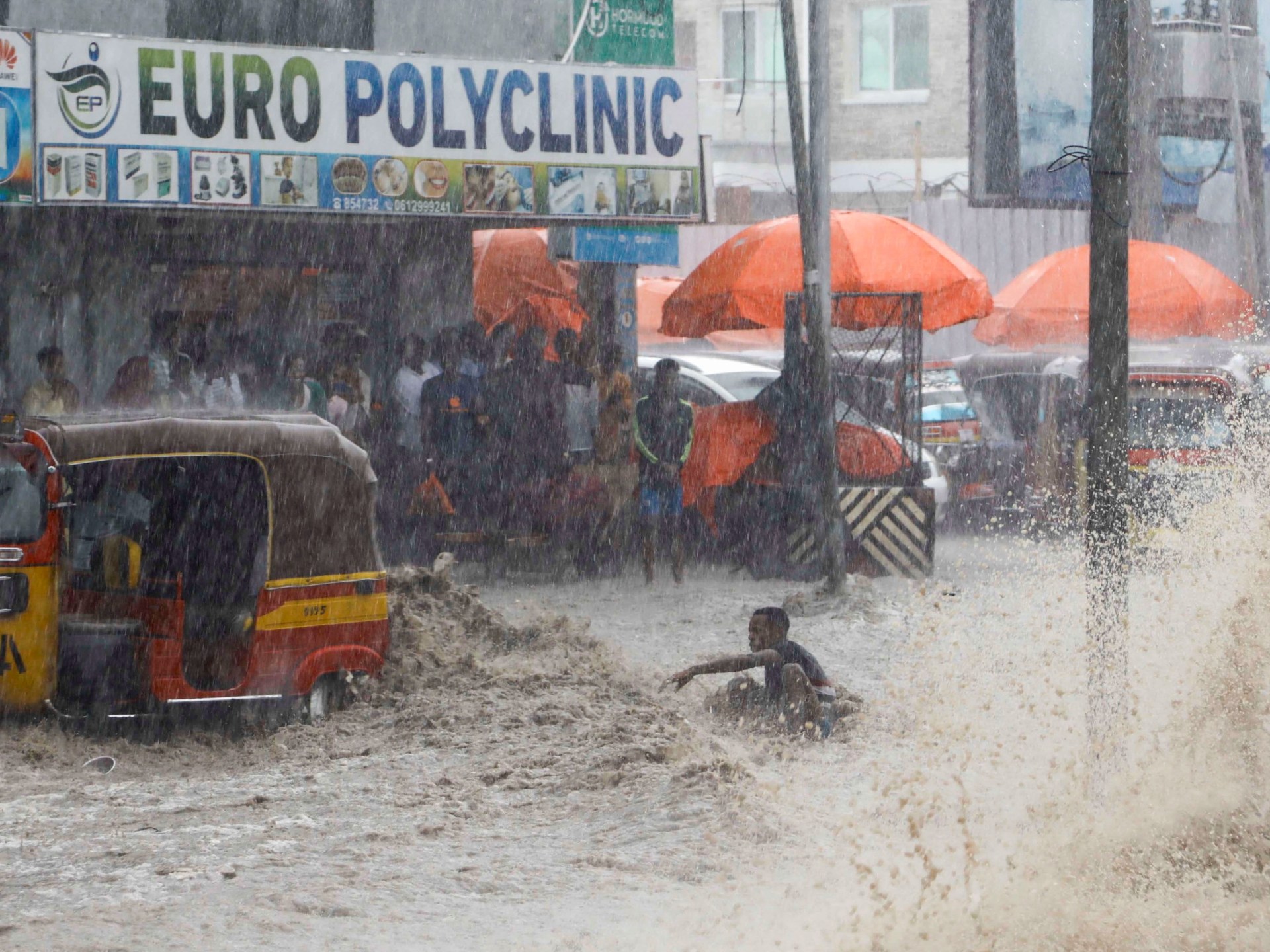
Winter solstice 2023 will mark the day with the fewest sunlight hours and coincides with the Ursid meteor shower.

After weeks of dwindling daylight, Friday marks the longest night of the year and the day with the fewest light of the year. The event is known as winter solstice as it marks the start of winter in the northern hemisphere.

The event will also be a turning point for longer hours of daylight in the northern hemisphere, a phenomenon that has been tied to various cultural and folkloric beliefs in ancient times.

Here’s what to know about the 2023 winter solstice and how it is celebrated in different communities.

What is winter solstice and what happens during it?

December’s winter solstice is when the northern half of the Earth is tilted furthest away from the sun, making it the “astronomical” first day of winter.

The northern hemisphere will experience the fewest hours of sunlight, making it the shortest day of the year while the night is the longest.

The duration of daylight will vary across countries. In the United Kingdom’s London, the day is expected to last seven hours and 49 minutes, more than eight hours shorter than the longest day of the year.

The event will also coincide with the peak of the Ursid meteor shower – an annual display that occurs over the northern hemisphere when the Earth passes through debris left by the comet 8P/Tuttle.

Every day after the winter solstice will grow longer in the northern hemisphere until its summer solstice, or the longest day of the year, between June 20 and 22.

Solstice comes from a Latin word translating to “sun stands still”.

When is the winter solstice?

This shortest day of the year will occur on December 22, while the exact moment of the solstice will occur at 03:27 GMT – at this point, the Earth’s axis will be furthest from the sun.

This shift in axial tilts as the Earth orbits around the sun allows the world to experience varying degrees of sunlight on different days. Otherwise, the sun would remain directly above the equator and shed the same amount of light on the Earth throughout the year.

(Al Jazeera)

Is it also the summer solstice in the southern hemisphere?

The summer solstice in the southern hemisphere occurs at the same time as the winter solstice in the northern hemisphere.

Seasons of the northern and southern hemispheres are reversed, so countries such as Brazil and New Zealand will be experiencing the longest day of the year.

The winter solstice in the northern hemisphere can occur between December 20 to 23 but often falls on December 21 or 22.

The last time it occurred on December 23 was in 1903, while its next appearance on that date will be in 2303.

Three interesting facts about winter solstice

  • Although the solstice is said to mark the astronomical start of winter, the winter season or its meteorological first day occurs on a different date and is based on temperature records.
  • Standing outside at noon on December 22 will cast the longest shadow of the entire year.
  • At the moment of the winter solstice, the sun appears directly over the Tropic of Capricorn, which is located 23 degrees south of the equator.

What is winter solstice celebrated for?

Several cultures celebrate the winter solstice in different ways which tends to be rooted in almost supernatural or folkloric significance of the day in ancient times. Today, we understand the event in more scientific terms but people continue to enjoy old traditions.

For ancient people, the gradual increase in daylight hours after winter solstice marked a time of rebirth.

People in Denmark, Norway, and Sweden hold a multiday feast to celebrate Juul, or Yule, when ancient people would welcome the return of the Sun God. Scandinavians burn a Yule log to honour the God Thor, who was tasked with returning the sun’s warmth.

In Finnish myth, the waning daylight in the lead-up to the winter solstice is caused by a powerful and evil witch that holds the sun and the moon captive inside a mountain.

For people in Iran, winter solstice or the “Yalda festival” marks the day when Mithra, an angel of light, was thought to have been born.

In China, winter solstice is the “Dongzhi festival” when winter’s darkness begins to give way to light. Families eat special foods such as rice balls called tang yuan.

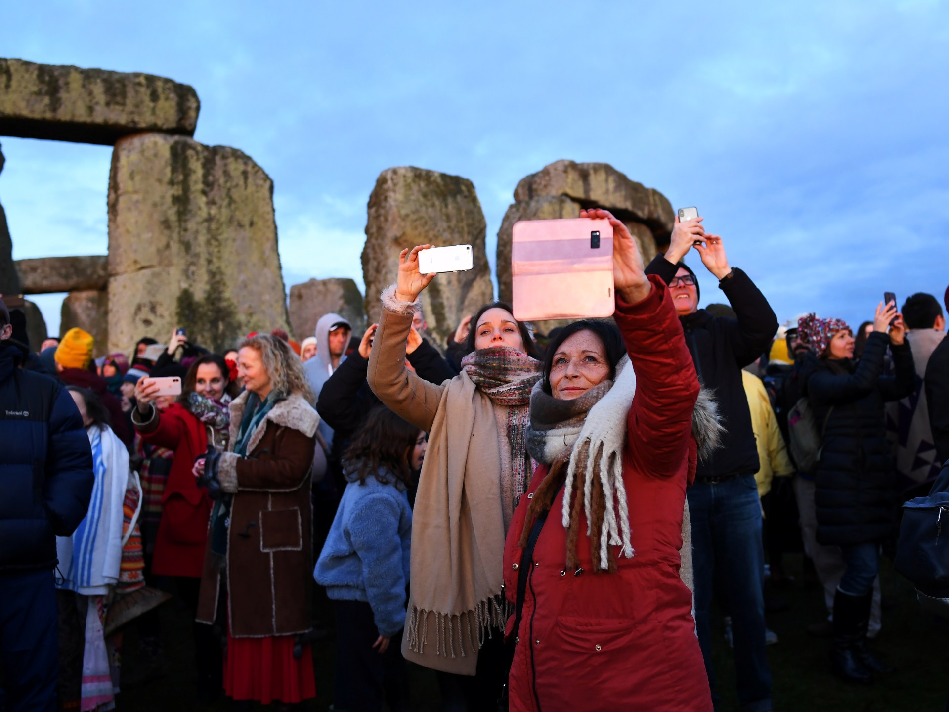
In the United Kingdom, people visit Stonehenge to catch the rays of the sunrise as they fall between the stones.

Check out our Latest News and Follow us at Facebook

Original Source

Cyclone Michaung nears southern Indian states, water enters Chennai airport | Weather News

At least four people have died, factories have closed and the runway of one of India’s busiest airports lies submerged due to torrential rain, as two southern Indian states brace for the impact of a severe cyclone.

Cyclone Michaung was expected to make landfall on the coast of the southern Indian state of Andhra Pradesh around noon (06:30 GMT) on Tuesday, the country’s weather office said.

Four people died in rain-related incidents in neighbouring Tamil Nadu state, including two killed when a building wall collapsed, the state’s disaster management minister and a top official in his department said.

In Tamil Nadu’s capital Chennai, the state’s largest city and a major electronics and manufacturing hub, cars were swept away as floodwater flowed through the streets, while the city’s airport, one of the busiest in India, shut operations until Tuesday morning.

Media showed pictures of grounded planes with their wheels submerged as the rain pelted down.

Taiwan’s Foxconn and Pegatron halted Apple iPhone production at their facilities near Chennai due to heavy rains, sources familiar with the matter told Reuters news agency.

Several areas of the city were submerged in knee-deep water and there have been power outages since Monday morning, a Reuters witness said, evoking memories of December 2015, when around 290 people died after catastrophic floods.

Authorities in both states were on high alert, evacuating thousands of people living in coastal areas, officials in both states said, with warnings issued to fishermen not to venture out to sea.

Schools, colleges, offices and banks were closed on Monday and Tuesday in at least four districts of Tamil Nadu, including Chennai, because of weather conditions, a government notice said.

Parts of Andhra Pradesh were likely to get more than 200mm (8 inches) of rain over the next 24 hours, India’s weather office said. Authorities in the state evacuated nearly 7,000 people in eight coastal districts and were preparing to evacuate a total of 28,000, depending on the cyclone’s path and severity, a senior official in the state’s disaster management department said.

At least 800 people have been evacuated so far from Bapatla, the coastal town in Andhra Pradesh where the cyclone is expected to make landfall on Tuesday, said P Ranjit Basha, district collector of Bapatla.

Check out our Latest News and Follow us at Facebook

Original Source

Floods, landslides kill dozens in northern Tanzania | Climate Crisis News

East Africa has been hit for weeks by torrential rain and flooding linked to the El Nino weather phenomenon.

At least 47 people have been killed and 85 others injured in landslides caused by flooding in northern Tanzania, says a local official, with warnings the toll could rise.

Heavy rain on Saturday hit the town of Katesh, some 300km (186 miles) north of the capital Dodoma, district commissioner Janeth Mayanja said.

“Up to this [Sunday] evening, the death toll reached 47 and 85 injured,” Queen Sendiga, regional commissioner in the Manyara area of northern Tanzania, told local media.

Both warned the death toll was likely to increase. Mayanja added that many roads in the area had been blocked by mud, water and dislodged trees and stones.

Tanzania’s President Samia Suluhu Hassan, in Dubai for the COP28 climate conference, sent her condolences and said she ordered the deployment of “more government efforts to rescue people”.

“We are very shocked by this event,” she said in a video message posted online by the Tanzanian Ministry of Health.

Vulnerable region

After experiencing an unprecedented drought, East Africa has been hit for weeks by torrential rain and flooding linked to the El Nino weather phenomenon.

El Nino is a naturally occurring weather pattern that originates in the Pacific Ocean and drives increased heat worldwide, bringing drought to some areas and heavy rains elsewhere.

The downpours have displaced more than a million people in Somalia and left hundreds dead. In May, torrential rains caused devastating floods and landslides in Rwanda that killed at least 130 people.

The Horn of Africa is one of the most vulnerable regions to climate change, with extreme weather events growing increasingly common and intense.

Since late 2020, Somalia as well as parts of Ethiopia and Kenya have been suffering the region’s worst drought in 40 years.

In 2019, at least 265 people died and tens of thousands were displaced during two months of relentless rainfall in several countries in East Africa.

The impact of El Nino, a weather pattern that contributes to rising global temperatures, can be exacerbated by climate change, scientists say.

In response, African leaders are pushing for new global taxes and changes to international financial institutions to help fund climate change action.

The launch of a “loss and damage” fund at the COP28 summit in Dubai earlier this week was hailed as a historic as it will see the biggest historical polluters pay for the damages sustained by countries that have been hit the hardest by the climate crisis, while also being the least responsible for it.

But details of the fund have not been fleshed out, and while 118 countries have pledged to boost clean energy at the summit, the world continues to fall far short of the Paris Agreement’s target of limiting global warming to 1.5 degrees Celsius (2.7F).

Scientists expect the worst effects of the current El Nino will be felt at the end of 2023 and into next year.

Check out our Latest News and Follow us at Facebook

Original Source

Late season winter storm blasts Upper Midwest with blizzard conditions, heavy snow

A weather system that brought severe storms over the weekend is bringing blizzard conditions to parts of the Upper Midwest to start the workweek. 

A cold front swept through the country’s eastern half and produced a plethora of weather events Sunday, including rain and severe storms. 

Many communities that saw record heat to end the workweek will be the recipients of precipitation as the front continues to move east. 

Winter weather alerts, including Blizzard Warnings, have been posted for the Upper Midwest, as some areas could see more than a foot of snow through Monday evening. 

Who is seeing snow?

Falling temperatures throughout the day will help many communities in the Upper Midwest fall to near freezing and see either freezing rain or snow.

Cities like Chicago and points northward will all see a good chance that frozen precipitation during the start of the workweek.

Forecast models show Minneapolis could get around 3 inches of snow while communities in northern Wisconsin and the Upper Peninsula of Michigan could see the brunt of the winter weather with more than a foot possible.


Winter weather alerts have been posted for the Upper Midwest, as some areas could see more than a foot of snow through Monday evening. 
Fox Weather

This image shows the possible additional snow totals through Monday.
Fox Weather

For most of the Midwest, the snow event will be considered a nuisance with only minor travel delays. For communities along Lake Superior, major travel disruptions are expected due to the heavier snow.

Check out our Latest News and Follow us at Facebook

Original Source

Oregon avalanche sweeps snowboarder over volcano cliff to his death, sheriff says

Two Oregon skiers watched as their friend was swept over a snow-covered volcano cliff and died as a result of the fall, authorities said.

A search and rescue team with the Deschutes County Sheriff’s Office was dispatched at about 12:45 p.m. Wednesday to a report of an avalanche at Paulina Peak in Newberry National Volcanic Monument.

The International Emergency Coordination Response Center (IERCC) informed deputies that they had received an SOS alarm from a device and provided GPS coordinates for the location. 

A second alert from the device stated there had been an avalanche, and that CPR was in progress on a person who was not breathing.

The person caught in the avalanche was later identified as 33-year-old Erik Hefflefinger of Bend, Oregon. 

According to his friends and other skiers on the scene, they witnessed the avalanche from below and saw Hefflefinger being carried over a cliff band by the avalanche debris, authorities said.

Hefflefinger was located by his friends, who were not buried by the avalanche, and immediately started lifesaving efforts. 


The person caught in the avalanche was identified as 33-year-old Erik Hefflefinger of Bend, Oregon.
Facebook/Erik Maxim

According to his friends and other skiers on the scene, they witnessed the avalanche from below and saw Hefflefinger being carried over a cliff band, authorities said.
Getty Images

Life-saving measures were performed, however, Hefflefinger succumbed to his injuries.
Getty Images/iStockphoto

Snow conditions limited the arrival of some first responders, but successful air rescue operations allowed crews to reach Hefflefinger about 3 hours after the avalanche.

Life-saving measures were performed after discovering his faint pulse. However, the man succumbed to his injuries.  

As a result of the investigation, deputies said the victim possibly hit a tree while caught in the avalanche debris. 

Hefflefinger’s death was not the first of the year in Deschutes County. Two prior avalanche fatalities have been investigated since January, deputies said.  Before these tragedies, it had been 9 years since a fatality was recorded due to an avalanche.

The summit of Paulina Peak with an elevation of 7,984 feet, is the highest point on the Newberry Volcano, according to the U.S. Department of Agriculture Forest Service.

Check out our Latest News and Follow us at Facebook

Original Source

Significant coast-to-coast US storm to impact millions this week with snow, ice, flooding

The FOX Forecast Center is tracking a significant, long-duration coast-to-coast storm that will sweep across the country this week bringing heavy snow, ice, flooding rain and severe weather to millions of Americans.

The winter weather is expected to start Monday in the West and quickly spread across the country, producing hazardous travel on Tuesday, Wednesday and Thursday for many communities north of Interstate 80.

“As we go into Wednesday morning, this is when things really begin to ramp up. Low pressure ejects out of the Rockies, and we start to see that snow belt extend across the northern tier from Nebraska, up across into Wisconsin,” said FOX Weather meteorologist Jane Minar.

Unlike with a classic dip in the jet stream, where cold air reaches far south, the flow across the country will allow warm air to be present, keeping the southern tier of the US quite warm and leading to a sharp boundary for who sees what form of precipitation.

Western US up first

The impending winter storm system is expected to be part of a prolonged period of cold weather in the West.

The FOX Forecast Center expects 8-12″ of snow to fall in the highest peaks of the Northern Rockies before the main storm system’s impacts begin to be felt.

Starting late Monday, heavy snow will be possible in the Mountain West and rain will likely be in the lower elevations and along the Pacific coast.


The US will be hit with a prolonged period of cold air.
FOX Weather

Forecast models show the threat of snow lingering for much of the workweek, despite the main storm system exiting eastward.

Accumulations could approach 2 feet in some of the Cascades, and snowfall gauges could reach several feet in the Rockies.

Despite the center of the storm system exiting quickly to the east, the unsettled weather pattern is expected to remain in place through Friday.

Midwest in bull’s-eye for significant winter weather impacts

The FOX Forecast Center will be tracking temperatures closely to determine where the freezing line sets up.

Communities around the 32-degree mark could see a significant threat of ice accretion, with those to the north seeing heavy snow and those farther to the south seeing all rain.

Based on the latest forecast models, the freezing line appears like it will stretch from Des Moines, Iowa, to New York and parts of New England. With this outcome, major metros such as Chicago, Milwaukee, Detroit and Cleveland could see a threat of ice.


There will be heavy snow accumulating throughout the Midwest this week.
AP Photo/Nam Y. Huh

This set up puts cities such as Sioux Falls, South Dakota, Minneapolis and Green Bay in the colder zone, and they’ll likely be the recipients of moderate to heavy snow.

Due to warm air being in place not too far away, communities in the central Mississippi and Ohio valleys are only expected to see liquid precipitation and possibly a lot of it. The FOX Forecast Center said 2-3″ of rain could fall in these regions by Thursday.

Because of the heavy rain, there is a risk of flooding.

On Tuesday and Wednesday morning, the flash flood threat will be centered across portions of northern Kentucky, southern, Illinois, southern Indiana and extreme southwestern Ohio.

A larger area will be at risk of flash flooding on Wednesday and Thursday morning.

Severe storms are likely on Wednesday as a new storm pulls in Gulf of Mexico moisture. Large hail, damaging winds and tornadoes are possible. Heavy rains will mean the threat for flash flooding across the southern Mississippi and Ohio River valleys.

Areas at risk stretch from northeastern Texas to the Mississippi and Ohio valleys.

Severe weather could also be an issue on Wednesday.

The FOX Forecast Center says there is the risk of severe weather from West Texas, including the Houston area, across the Mississippi Valley and into portions of the Tennessee Valley.

However, areas seeing a higher risk of severe thunderstorms on Wednesday include portions of northern Louisiana, most of Arkansas, northwestern Mississippi and parts of southwestern Tennessee.

Northeast heavy ice potential

As the storm system traverses the country, its precipitation shield is expected to start impacting Northeast states on Wednesday.

Due to warm air in place, not all precipitation is expected to fall in the frozen variety, but many communities in New York and southern New England could see significant ice accretions.


The snow will hit heavy in the East during the later part of the week.
FOX Weather

Generally, ice accretions of less than a quarter inch are considered to be a nuisance, but totals that close in on a half an inch or more can lead to widespread problems such as power outages and tree damage.

“We could see a little bit of snow across the interior portions of the Northeast, but it won’t be good enough for that I-95 corridor. We are anticipating just too warm of temperatures,” said Minar.

In addition to the threat of rain, snow, sleet and freezing rain, the storm system will also help knock temperatures below average for millions in the country’s northern tier.

Check out our Latest News and Follow us at Facebook

Original Source

How the weather could impact Election Day 2022

A busy election cycle means millions of voters will cast ballots that will determine the balance of power for the next two years, but political experts say Mother Nature might have a say in which races may see a higher turnout.

On Tuesday, all 435 seats in the House of Representatives are up for grabs, and voters will decide on 35 seats in the Senate.

Many of the races are considered to be a dead heat, and it could come down to turnout that will decide who controls the legislative branch.

Dr. David Richards, an associate professor and political chair at the University of Lynchburg, is watching a slew of races closely and said that the smallest impacts could significantly influence who will claim victory.

“Higher turnout means inevitably you have less of the party faithful. The smallest of factors could impact turnout, and that even includes the weather,” Richards said.

A collaborative study published in The Journal of Politics found that the correlation between bad weather and voter turnout may be more than a fluke theory that is trotted out as a talking point every November.

The first visible lunar eclipse will be visible on Election Day in the U.S. takes place.
Fox Weather

The authors found that voter participation dropped off about one percent per inch of rain, and snowfall decreased turnout by nearly half a percent for every inch of accumulation. 

Research published in the journal Frontiers in Psychology found that voter turnout increased by 0.14% for every 1.8 °F jump in temperature.

Additionally, the research found that warmer temperatures generally increased the likelihood that voters kept the incumbent party in power.

“Generally, the trend of more and more early voting means weather on Election Day plays a smaller and smaller role, but there are some caveats. The less dedicated often now wait until Election Day if they vote at all, meaning any weather setback, like rain or cold, will be more likely to put off these more casual voters,” Richards stated.

Here are the five things to know about the forecast for Election Day.

It’s going to be warm in most of the country

Most communities east of the Rockies will see temperatures either at or above average due in part to a massive ridge of high pressure.

Any weather setback, like rain or cold, will be more likely to put off more casual voters,” Richards stated.
Fox Weather

Temperatures in the 60s could reach as far north as South Dakota, and the Ohio Valley is expected to see temperatures reach the 70s on Election Day.

Richard believes the warm weather could help keep turnout high in several eastern states but warns due to early voting, there will come a point when turnout begins to taper off well ahead of the scheduled precinct closing times.

“In Pennsylvania, Georgia and Florida voting has been strong, but because of sheer numbers, turnout on Election Day will be lower because you run out of interested voters at some point,” Richards said.

There will be a lunar eclipse

History will be in the making in the skies as the first visible lunar eclipse on a major Election Day in the U.S. takes place.

The moon will briefly be covered by the Earth’s shadow as the sun and the moon align with our planet.

The eclipse is expected to begin around 5:17 a.m. EST and peak just before 6 a.m. on Tuesday.

The celestial event will be over before the polling precincts open at 7 a.m. on the East Coast, but Richards warns people might hark back to the saying there “must be a full moon” if something unexpected happens in the political world.

A non-tropical low-pressure system is could develop over the southwest Atlantic and areas off the coast of the Southeast.
Fox Weather

People regularly associate odd occurrences with the full moon, but there is little truth to the folklore.

“Studies have found minor effects on circadian rhythms. Significant enough they have found patterns but not significant enough that force people got nuts or something similar to that,” Richards said. “If people are paying attention to it, they’re going to say, ‘okay, here’s an election where these two events are happening.’ It is an interesting coincidence but nothing more than that,” Richards said.

A storm system will keep the Southeast coast unsettled

A non-tropical low-pressure system is expected to develop over the southwest Atlantic and meander off the coast of the Southeast.

Depending on the exact location of the low and a pressure gradient that forms north of the center, blustery conditions and scattered showers are expected to develop.

If the low ventures close to shore, scattered showers from the Carolinas to Florida are possible.

The impacts will be more of the nuisance variety and cause nor’easter conditions along the coast.

Severe weather is not anticipated, but winds could keep Tuesday blustery.

The FOX Forecast Center said the National Hurricane Center is monitoring the potential disturbance for the chance of tropical or subtropical development, but even if the system earns a name, the impacts are expected to remain the same.

West Coast could deal with various forms of precipitation

A significant storm system could be underway across the Rockies and the West that could cause some turbulent weather.

Forecast models show rain in lower valleys and snow in higher elevations.

The weather system will enable a continued stormy pattern and help the cooler weather prevail for large parts of the region.

The Desert Southwest is one of the few areas that will likely escape significant impacts from the precipitation, but temperatures will be below average.

Check out our Latest News and Follow us at Facebook

Original Source

NYC metropolitan area under flash flood warning today as storms hit region

Get those umbrellas and rainboots ready for the morning commute.

Areas of the New York metro region are under a flash flood warnings as storms creep into the northeast and showers are expected to continue throughout the day.

Queens, Brooklyn, Manhattan, and Staten Island, along with parts of New Jersey and Long Island, have already experienced 2 inches of rain overnight, with 1 to 2 more inches expected in the next several hours.

Winds are currently fluctuating between 10 to 15 mph out of Kennedy and LaGuardia airports and are expected to stay that way until the early afternoon.

By the late evening, the storm will have left the area, and winds are expected to die down.

Other areas in and near the metropolitan area may be put under weather advisories in the coming hours as the storm approaches.

A tornado watch for Kings County previously made early has been canceled.

The storm began affecting the areas Tuesday morning, and humidity is said to drop by Wednesday afternoon.

From Wednesday through the rest of the week, it is reported to be clear skies and sunny, with temperatures reaching the mid-70s to low 80s.

Check out our Latest News and Follow us at Facebook

Original Source

Scorching temperatures, rain could bring sad end to summer

It was bound to happen, America. Summer is coming to a close. But not before we get one more celebration in to hold onto the dog days of summer.

Millions of people will be hitting the roads and taking to the skies to celebrate Labor Day. But for millions of Americans, scorching temperatures and the risk of rain and thunderstorms could dampen those last cookouts, clambakes and afternoons at the beach.

Here’s a closer look at the Labor Day holiday forecast from the FOX Forecast center.

Sunday

Heading into Sunday, the threat of rain and thunderstorms will shift a bit to the east.

The threat will linger for the Lone Star State and along the Gulf Coast, but chances for showers extend north through the Mississippi and Kentucky valleys, as well as the Great Lakes and into the Northeast.

Rain chances will also be seen in the mid-Atlantic and Southeast.

Temperature-wise, the FOX Forecast Center is seeing another day of triple-digit temperatures in parts of the West and Southwest, while places around Atlanta will reach the 80s.

From the mid-Atlantic and Northeast, temperatures will also be in the mid- to upper 80s.

Seattle will again hover around the 80-degree mark as well, and Billings will be “slightly cooler” than Saturday with a forecast high of about 97 degrees.

Heading into Sunday, the threat of rain and thunderstorms will shift a bit to the east.

And heads up, this has also been the summer of the shark along East Coast beaches.

Several shark attacks were reported in New Jersey and New York, putting beachgoers on edge.

And on Cape Cod in Massachusetts, at least 20 sharks were spotted in the water over the course of a week.

Rain chances will also be seen in the mid-Atlantic and Southeast.

If you’re going to the airport on Sunday, you may need to prepare for delays and cancelations depending on where you’re catching a flight.

The FOX Forecast Center is expecting some issues at airports in Boston due to weather, and major airports in the South and Southeast are also at-risk of seeing some problems.

Dallas, Houston, New Orleans, Memphis, Atlanta and Orlando could all see some issues, so check with your airline directly for the latest information.

If you’re going to the airport on Sunday, you may need to prepare for delays and cancelations depending on where you’re catching a flight.

Monday

Monday – Labor Day. The unofficial end to summer.

The threat of sub-par weather will continue across the eastern half of the United States, with more chances of rain and thunderstorms across places from the Southwest, Midwest and Northeast.

There’s a chance of rain from Norfolk, Virginia, north through the Big Apple and New England, but temperatures will range from the low to mid-80s across much of the region.

If you’re looking for sunshine (like most people), you’ll want to head west.

Denver will be very hot at 95 degrees with plenty of sun, and the heat will extend to Billings, where the area will likely see a high temperature of around 97 degrees.

Temperatures get hotter the further west you go, so places like Reno will see a high temperature of about 100 degrees on Labor Day.

Temperatures will remain on the cool side in the Seattle area, where the Emerald City will likely remain in the mid-70s.

If you’ve been meaning to get out to one of our country’s beautiful national parks before the end of summer, you’ve got a lot of catching up to do if you want to be like this grandma-grandson duo.

Grandma Joy Ryan and her 41-year-old grandson have been crisscrossing the country on a mission to visit every single national park in the country, and they’ve only got one left to visit.

Their ambitious quest began with a road trip to the Great Smoky Mountains National Park in 2015. In the past seven years, these intergenerational travelers have driven more than 50,000 miles to visit 62 out of 63 parks on their bucket lists.

In terms of issues at the airports in the country, most of the problems will likely be in the same locations that could see delays and cancellations over the course of Labor Day weekend.

Houston, New Orleans, Memphis, Atlanta and Orlando will likely see more issues, and passengers should arrive at the airport with plenty of time to space in order to get through security and check bags.

But, again, don’t waste a trip to the airport if you don’t have to – reach out to the airline directly to make sure things remain on the up and up.

Check out our Latest News and Follow us at Facebook

Original Source

Florida swirling waterspout spotted in Destin

A large waterspout was spotted off the coast of Florida Tuesday morning — leaving spectators to the natural phenomenon in a state of awe, according to news reports and videos shown on social media.

The stunning scene near the city of Destin was captured by a person on the beach who could be heard saying, “Look at that dude, that’s a big ‘un,” according to video posted by weather.com.

The National Weather Service of Mobile, Alabama and Pensacola, Florida, said in a tweet that storms in the area were producing a large waterspout off shore as the agency warned boaters to use caution. The tweet also said the storm appeared to be moving parallel to the coast off Miramar Beach.

Another video shared by the Weather Service shows a driver capturing the moment as a car drives along a Florida highway around 6 a.m. central time.

The National Weather Service called the waterspout “a rather impressive one” as it explained in a series of tweets how the weather event can form.

The National Weather Service said they are like tornadoes over water and can be broken into either fair weather waterspouts of tornadic waterspouts.

Fair weather ones are usually the less dangerous of the two and can be common over South Florida’s coast from late spring to early fall, according to the Weather Service.

Check out our Latest News and Follow us at Facebook

Original Source

Exit mobile version